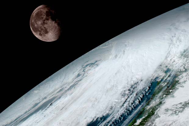
 The first set of images from the GOES-16 satellite have been released by National Oceanic and Atmospheric Administration (N0AA). The geostationary satellite will be used for weather forecasting, severe storm tracking and more.
The first set of images from the GOES-16 satellite have been released by National Oceanic and Atmospheric Administration (N0AA). The geostationary satellite will be used for weather forecasting, severe storm tracking and more.
The first set of images from the GOES-16 satellite have been released by National Oceanic and Atmospheric Administration (N0AA). The geostationary satellite will be used for weather forecasting, severe storm tracking and more.
Share this Article
Recommended